- ABOUT US
- ABOUT US
- AXES AND PROJECTS
- AXES, CAMPAIGNS AND PROJECTS
-
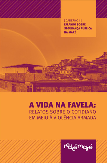
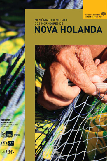
PUBLICATIONS
- SEE ALL PUBLICATIONS »
- Redes da Maré's Analysis
- Bulletin The Right to Public Security in Maré
- Estudos urbanos e socioambientais
- Researches
- Books
- Planos e Cartas
- Guides
- Editais
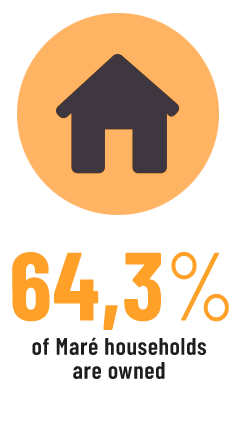
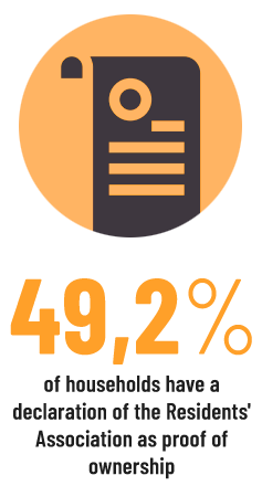
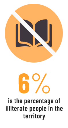
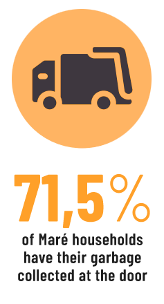
- Census Maré
- Bulletin Health Connection: Eyes on Corona
- Other Reports
- Annual Reports
- Contracts with the Municipality, State and Federal
- Emendas parlamentares
- Relatórios financeiros
- Estatutos, atas e políticas da Redes da Maré
- Transparency
- SEE ARTICLES AND COLUMNS »
- Redes da Maré's Notes
- Testemunhos de dentro
- Eliana Sousa Silva's Articles
- Invited Authors Articles
- Interviews
- Column Who Makes Redes
- MARÉ DE NOTÍCIAS
- NEWSLETTERS
- REDES CHANNEL
- PUBLICATIONS
- TRANSPARENCY
- CONTACT
- PORTUGUÊS
- DONATE NOW!